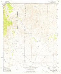
1973 Map of Galleta Flat West
USGS Topo · Published 1976About this map
The Rincon Mountains dominate this 1970s landscape, where the high-elevation terrain of the Coronado National Forest and Saguaro National Monument meets the arid lowlands. A network of seasonal drainages, including Martinez Wash, Cumaro Wash, and Agua Verde Creek, carves through the foothills toward the Galleta Flat. This area illustrates a sparse ranching and spiritual settlement pattern, anchored by Mackenzie Ranch and Ashrama Ranch. The presence of several prospects and isolated watering points like Canoa Spring and Rock Pile Tank highlights the difficulty of resource extraction and livestock management in this environment. Significant landmarks for local history include the remote White Cross Cem and the prominent North Star Peak, which towers over the Pima and Cochise County line.
Find a feature on this map
27 named features on this map. Tap any name to fly to it.
Don’t see what you’re looking for? This feature index may not catch every label — zoom into the map to look around manually.
Map Details
Editions of this 1973 Galleta Flat West Map
2 editions found
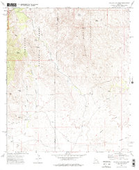
Other maps of this area

1904 · Patagonia
USGS Topo · 1:125,000

1904 · Tucson
USGS Topo · 1:125,000

1905 · Patagonia
USGS Topo · 1:125,000

1905 · Tucson
USGS Topo · 1:125,000

1915 · Benson
USGS Topo · 1:125,000

1926 · Whetstone
USGS Topo · 1:62,500

1943 · Benson
USGS Topo · 1:125,000

1945 · Happy Valley
USGS Topo · 1:62,500

1956 · Nogales
USGS Topo · 1:250,000

1956 · Tucson
USGS Topo · 1:250,000