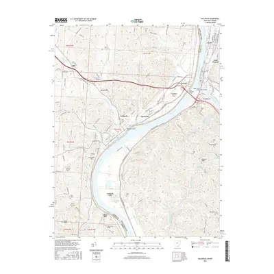
2016 Map of Gallipolis
USGS Topo · Published 2016About this map
The Ohio River serves as the central artery and state boundary between Ohio and West Virginia, anchoring a landscape shaped by river transport and floodplain settlement. On the Ohio side, the city of Gallipolis and the village of Kanauga are connected to Point Pleasant and Henderson in West Virginia by a trio of crossings: the Silver Memorial Bridge, the Bartow Jones Bridge, and the Shadle Bridge at the mouth of the Kanawha River. The terrain is marked by distinctive ridges like Shoestring Ridge and Kriner Ridge, while the riverfront is defined by Gallipolis Island and The Sound. Local history is deeply etched into the land through numerous small burial grounds, including the Mound Hill Cem near Fortification Hill and the Pioneer Cem in Point Pleasant. This survey documents the modern infrastructure of the region, from the Gallia-Meigs Regional Airport to the industrial and residential clusters at Gallipolis Ferry and Clipper Mills.
Find a feature on this map
142 named features on this map. Tap any name to fly to it.
Don’t see what you’re looking for? This feature index may not catch every label — zoom into the map to look around manually.
Map Details
Editions of this 2016 Gallipolis Map
This is the sole edition of this map. No revisions or reprints were ever made.
Other maps of this area

1906 · Bidwell
USGS Topo · 1:62,500

1906 · Athalia
USGS Topo · 1:62,500

1906 · Glenwood
USGS Topo · 1:62,500

1908 · Bidwell
USGS Topo · 1:62,500

1908 · Athalia
USGS Topo · 1:62,500

1908 · Glenwood
USGS Topo · 1:62,500

1908 · Point Pleasant
USGS Topo · 1:62,500

1926 · Point Pleasant
USGS Topo · 1:62,500

1929 · Point Pleasant
USGS Topo · 1:62,500

1957 · Beech Hill
USGS Topo · 1:24,000