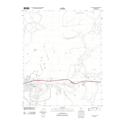
2010 Map of Gallup East
USGS Topo · Published 2010About this map
Gallup serves as the focal point of this 2010 survey, illustrating a landscape where industrial heritage meets educational and community expansion. The eastern portion of the city is marked by a high density of former mining operations, with names like the William Coal Company Mine, Thatcher Mine, and New Otero Mine peppering the canyons. These mines, situated within Gibson Canyon and Heaton Canyon, reflect the extensive coal-producing history that fueled the region's growth along the Puerco River.
Find a feature on this map
59 named features on this map. Tap any name to fly to it.
Don’t see what you’re looking for? This feature index may not catch every label — zoom into the map to look around manually.
Map Details
Editions of this 2010 Gallup East Map
This is the sole edition of this map. No revisions or reprints were ever made.
Other maps of this area

1886 · Wingate
USGS Topo · 1:250,000

1892 · Wingate
USGS Topo · 1:250,000

1954 · Gallup
USGS Topo · 1:250,000

1958 · Gallup
USGS Topo · 1:250,000

1959 · Gallup
USGS Topo · 1:250,000

1962 · Gallup
USGS Topo · 1:250,000

1963 · Twin Lakes
USGS Topo · 1:24,000

1963 · Big Rock Hill
USGS Topo · 1:24,000

1963 · Twin Buttes
USGS Topo · 1:24,000

1963 · Gallup West
USGS Topo · 1:24,000