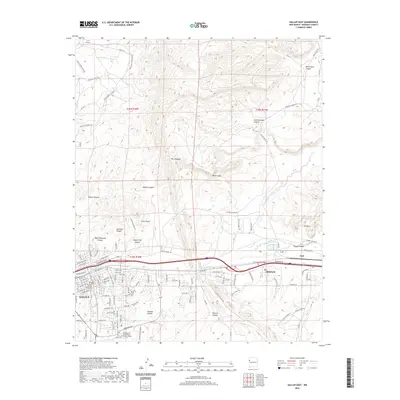
2020 Map of Gallup East
USGS Topo · Published 2020About this map
The Puerco River corridor defines the heart of this region, serving as the primary axis for both natural drainage and modern infrastructure. To the west, the city of Gallup serves as a significant hub, anchored by institutional landmarks such as the McKinley County Courthouse and the University of New Mexico - Gallup Campus. Moving eastward, the landscape transitions into a series of dramatic geological formations, most notably the high ridges of The Hogback and the striking White Cliffs. The settlement of Rehoboth sits nestled near the river forks, while the eastern reaches are characterized by numerous named canyons including Cliff Dwellers Canyon, Superman Canyon, and Black Diamond Canyon. This geography highlights the intersection of high-desert terrain with the development patterns of the early twenty-first century, where local roads like Hasler Valley Rd and Padre Canyon Rd navigate the rugged breaks between plateaus and the river valley.
Find a feature on this map
117 named features on this map. Tap any name to fly to it.
Don’t see what you’re looking for? This feature index may not catch every label — zoom into the map to look around manually.
Map Details
Editions of this 2020 Gallup East Map
This is the sole edition of this map. No revisions or reprints were ever made.
Other maps of this area

1886 · Wingate
USGS Topo · 1:250,000

1892 · Wingate
USGS Topo · 1:250,000

1954 · Gallup
USGS Topo · 1:250,000

1958 · Gallup
USGS Topo · 1:250,000

1959 · Gallup
USGS Topo · 1:250,000

1962 · Gallup
USGS Topo · 1:250,000

1963 · Twin Lakes
USGS Topo · 1:24,000

1963 · Big Rock Hill
USGS Topo · 1:24,000

1963 · Twin Buttes
USGS Topo · 1:24,000

1963 · Gallup West
USGS Topo · 1:24,000