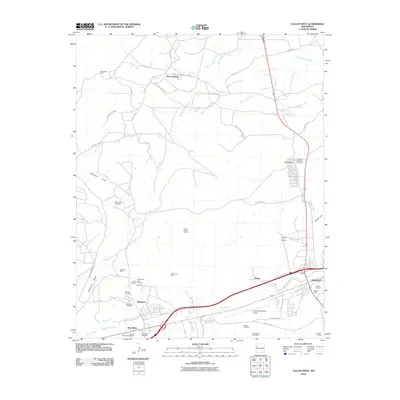
2010 Map of Gallup West
USGS Topo · Published 2010About this map
The industrial coal-mining landscape of McKinley County is documented here during the early 21st century, centered on the western edges of Gallup and the dedicated mining communities of Gamerco and Mentmore. The sheet reveals an extensive network of mineral extraction sites, including the Gibson Number 4 Mine, Navajo Number Five Mine, and the Enterprise Mine. These operations are situated among the high desert drainages of Burned Death Wash and Many Arrow Wash, where the terrain transitions into the Coal Basin.
Find a feature on this map
59 named features on this map. Tap any name to fly to it.
Don’t see what you’re looking for? This feature index may not catch every label — zoom into the map to look around manually.
Map Details
Editions of this 2010 Gallup West Map
This is the sole edition of this map. No revisions or reprints were ever made.
Other maps of this area

1886 · Wingate
USGS Topo · 1:250,000

1892 · Wingate
USGS Topo · 1:250,000

1954 · Gallup
USGS Topo · 1:250,000

1958 · Gallup
USGS Topo · 1:250,000

1959 · Gallup
USGS Topo · 1:250,000

1962 · Gallup
USGS Topo · 1:250,000

1963 · Twin Lakes
USGS Topo · 1:24,000

1963 · Big Rock Hill
USGS Topo · 1:24,000

1963 · Twin Buttes
USGS Topo · 1:24,000

1963 · Gallup West
USGS Topo · 1:24,000