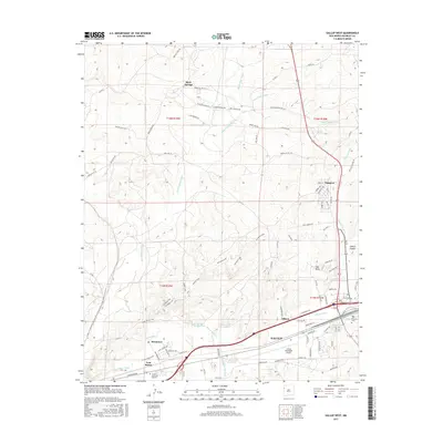
2017 Map of Gallup West
USGS Topo · Published 2017About this map
Gallup serves as the central hub in this western McKinley County landscape, where the Puerco River corridor shapes the primary east-west transportation and settlement patterns. The map documents a complex network of mesa loops and drainage washes, including 2nd Mesa Loop and Black Ridge Wash, which define the rugged topography north of the city. Industrial and residential footprints are evident in the outlying communities of Gamerco, Mentmore, and Allison, while the Gallup Municipal Airport anchors the southwestern urban boundary. Genealogists will find the locations of Hillcrest Cem and Sunset Memorial Gardens valuable for local research. This 2017 survey illustrates the persistent importance of named springs and washes like China Springs and Many Arrow Wash in an arid region where water features have historically dictated land use and route placement.
Find a feature on this map
92 named features on this map. Tap any name to fly to it.
Don’t see what you’re looking for? This feature index may not catch every label — zoom into the map to look around manually.
Map Details
Editions of this 2017 Gallup West Map
This is the sole edition of this map. No revisions or reprints were ever made.
Other maps of this area

1886 · Wingate
USGS Topo · 1:250,000

1892 · Wingate
USGS Topo · 1:250,000

1954 · Gallup
USGS Topo · 1:250,000

1958 · Gallup
USGS Topo · 1:250,000

1959 · Gallup
USGS Topo · 1:250,000

1962 · Gallup
USGS Topo · 1:250,000

1963 · Twin Lakes
USGS Topo · 1:24,000

1963 · Big Rock Hill
USGS Topo · 1:24,000

1963 · Twin Buttes
USGS Topo · 1:24,000

1963 · Gallup West
USGS Topo · 1:24,000