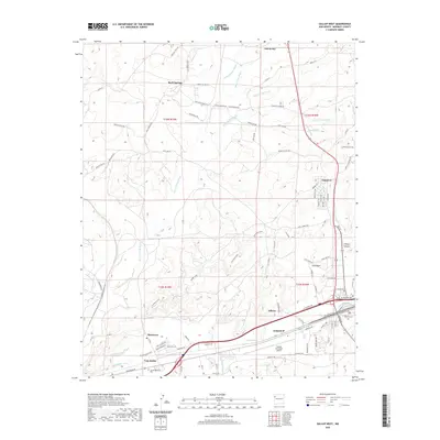
2020 Map of Gallup West
USGS Topo · Published 2020About this map
The Puerco River corridor defines this landscape west of Gallup, where the confluence of rail, mining, and highway infrastructure meets the high desert terrain. The industrial history of the region is evident at Coal-Basin and the settlement of Gamerco, north of the Gallup Municipal Airport. To the north, the community of Yah-ta-hey and Rock Springs sit among a complex network of named drainages, including Burned Death Wash, White Smoke Wash, and Many Arrow Wash. These seasonal waterways cut through the landscape, alongside landmarks like The Stem and Gibson Canyon. Genealogical and local history interest is concentrated at Hillcrest Cem and Sunset Memorial Park, while the Bnsf Railway line parallels the river through the southern part of the quadrangle, passing near Mentmore and Twin Buttes. The grid-like residential layouts of Allison and Gamerco provide a contrast to the surrounding network of service and tribal roads.
Find a feature on this map
89 named features on this map. Tap any name to fly to it.
Don’t see what you’re looking for? This feature index may not catch every label — zoom into the map to look around manually.
Map Details
Editions of this 2020 Gallup West Map
This is the sole edition of this map. No revisions or reprints were ever made.
Other maps of this area

1886 · Wingate
USGS Topo · 1:250,000

1892 · Wingate
USGS Topo · 1:250,000

1954 · Gallup
USGS Topo · 1:250,000

1958 · Gallup
USGS Topo · 1:250,000

1959 · Gallup
USGS Topo · 1:250,000

1962 · Gallup
USGS Topo · 1:250,000

1963 · Twin Lakes
USGS Topo · 1:24,000

1963 · Big Rock Hill
USGS Topo · 1:24,000

1963 · Twin Buttes
USGS Topo · 1:24,000

1963 · Gallup West
USGS Topo · 1:24,000