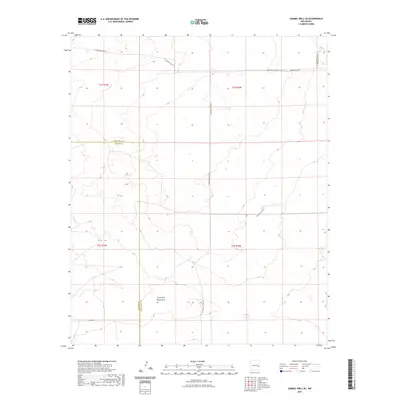
2023 Map of Gammil Well SE
USGS Topo · Published 2023About this map
The high plains along the border of Roosevelt and Chaves counties are characterized by a network of rural roads and scattered water resources. This landscape is oriented around the South Fork White Draw and various drainage features, which define the local topography. At the northern edge of the map, Ingram Cem serves as a quiet marker of the region's early residents, situated near the junction of S Roosevelt Road 10 and S Roosevelt Road 40.
Find a feature on this map
14 named features on this map. Tap any name to fly to it.
Don’t see what you’re looking for? This feature index may not catch every label — zoom into the map to look around manually.
Map Details
Editions of this 2023 Gammil Well SE Map
This is the sole edition of this map. No revisions or reprints were ever made.
Other maps of this area

1954 · Clovis
USGS Topo · 1:250,000

1954 · Brownfield
USGS Topo · 1:250,000

1958 · Brownfield
USGS Topo · 1:250,000

1958 · Clovis
USGS Topo · 1:250,000

1962 · Brownfield
USGS Topo · 1:250,000

1973 · Lewiston Lake
USGS Topo · 1:24,000

1973 · Gammil Well SE
USGS Topo · 1:24,000
1973 · Gammil Well
USGS Topo · 1:24,000

1973 · Gammil Well NE
USGS Topo · 1:24,000

1973 · Upton
USGS Topo · 1:24,000