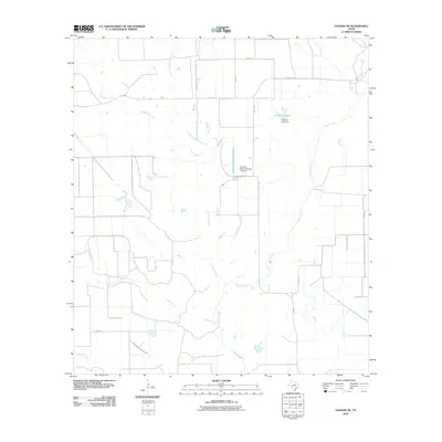
2010 Map of Ganado NE
USGS Topo · Published 2010About this map
Goldenrod Creek and Sandy Creek wind through this rural corner of Jackson County, carving a network of drainage channels that define the agricultural landscape. The area is characterized by large land tracts and a sparsely populated ranching or farming infrastructure, connected by a grid of county roads such as Co RD 395 and FM 1300 RD. Central to the activity of this region is the Stovall Ranch Number 1 Airport, a private airfield indicative of the large-scale ranching operations common in coastal Texas. Near the center of the survey, the Hutchins Lake Dam contains the waters of Hutchins Lake, providing a critical water resource for the surrounding pastures. The drainage patterns of Longs Branch and Brushy Creek further illustrate the low-lying, water-dependent nature of the local terrain as it appeared in the early 21st century.
Find a feature on this map
18 named features on this map. Tap any name to fly to it.
Don’t see what you’re looking for? This feature index may not catch every label — zoom into the map to look around manually.
Map Details
Editions of this 2010 Ganado NE Map
This is the sole edition of this map. No revisions or reprints were ever made.
Other maps of this area

1953 · Seguin
USGS Topo · 1:250,000

1958 · Seguin
USGS Topo · 1:250,000

1963 · Ganado
USGS Topo · 1:24,000

1963 · Mount Olive
USGS Topo · 1:24,000

1964 · Cordele
USGS Topo · 1:24,000

1964 · Speaks
USGS Topo · 1:24,000

1965 · Ganado NE
USGS Topo · 1:24,000

1965 · Sheridan SE
USGS Topo · 1:24,000

1965 · Gobbler Creek
USGS Topo · 1:24,000
1965 · Hahn
USGS Topo · 1:24,000