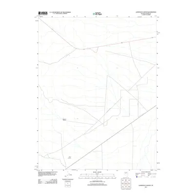
2011 Map of Gandolfo Canyon
USGS Topo · Published 2011About this map
Gandolfo Canyon and Ryan Canyon define the natural drainage and elevation patterns of this high-desert Lander County landscape. This 2011 survey illustrates the sparse but critical transportation infrastructure of the central Nevada basin, where the historical footprint of the Old Overland Rd intersects with modern routes. The placement of Road 215 alongside these deep canyon formations highlights the continued importance of these natural corridors for movement through the Great Basin. With very few named settlements, the focus remains on the sharp topographical changes and the isolation of these canyons within the larger mountain-and-valley system typical of the region.
Find a feature on this map
4 named features on this map. Tap any name to fly to it.
Don’t see what you’re looking for? This feature index may not catch every label — zoom into the map to look around manually.
Map Details
Editions of this 2011 Gandolfo Canyon Map
This is the sole edition of this map. No revisions or reprints were ever made.
Other maps of this area

1955 · Millett
USGS Topo · 1:250,000

1956 · Austin
USGS Topo · 1:62,500

1959 · Millett
USGS Topo · 1:250,000

1969 · Mount Airy
USGS Topo · 1:24,000

1969 · Vigus Butte
USGS Topo · 1:24,000

1969 · Gandolfo Canyon
USGS Topo · 1:24,000

1969 · Mount Airy Mesa
USGS Topo · 1:24,000

1969 · Emigrant Peak
USGS Topo · 1:24,000

1969 · Dutch Flat
USGS Topo · 1:24,000

1969 · Iron Mountain
USGS Topo · 1:24,000