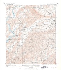
1915 Map of Gantts Quarry
USGS Topo · Published 1984About this map
Industrial activity and river transport define the landscape along the Coosa River in this early twentieth-century survey of Shelby, Talladega, and Coosa Counties. The area is characterized by a sophisticated rail network, with the Southern, Central of Georgia, and Louisville and Nashville railroads converging near the burgeoning town of Sylacauga. The economy of the era is anchored by extensive extraction and milling, specifically at Gantts Quarry and the Eureka Quarry, while smaller operations like Looneys Mill and Odens Mill point to local industry.
Find a feature on this map
64 named features on this map. Tap any name to fly to it.
Don’t see what you’re looking for? This feature index may not catch every label — zoom into the map to look around manually.
Map Details
Editions of this 1915 Gantts Quarry Map
4 editions found

Other maps of this area

1890 · Bessemer
USGS Topo · 1:125,000

1890 · Talladega
USGS Topo · 1:125,000

1891 · Clanton
USGS Topo · 1:125,000

1892 · Talladega
USGS Topo · 1:125,000

1892 · Bessemer
USGS Topo · 1:125,000

1901 · Wetumpka
USGS Topo · 1:125,000

1903 · Wetumpka
USGS Topo · 1:125,000

1906 · Vandiver
USGS Topo · 1:62,500

1908 · Vandiver
USGS Topo · 1:62,500

1909 · Columbiana
USGS Topo · 1:62,500