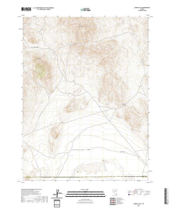
2021 Map of Garcia Flat
USGS Topo · Published 2021About this map
Garcia Flat dominates the lower elevations of this high-desert landscape where the borders of Elko and Eureka counties meet. The terrain is defined by significant peaks, including Bailey Mtn in the north and Black Mtn to the west, separated by a network of drainage systems and intermittent water sources. These water points, such as Bailey Spring, The Lumps Spring, and N T Springs, indicate the vital role of specific moisture sites in an otherwise arid environment. The map shows the land partitioned by the Public Land Survey System, with the intersections of t27n r53e and t27n r54e providing a grid over the complex topography. Red Rock Summit stands as a prominent navigational marker in the eastern section, overlooking the gradual transition from the mountains down toward the flat.
Find a feature on this map
13 named features on this map. Tap any name to fly to it.
Don’t see what you’re looking for? This feature index may not catch every label — zoom into the map to look around manually.
Map Details
Editions of this 2021 Garcia Flat Map
This is the sole edition of this map. No revisions or reprints were ever made.
Other maps of this area

1934 · Jiggs
USGS Topo · 1:125,000

1937 · Mineral Hill
USGS Topo · 1:48,000

1937 · Jiggs
USGS Topo · 1:125,000

1943 · Mineral Hill
USGS Topo · 1:62,500

1952 · Pine Valley
USGS Topo · 1:62,500

1955 · Winnemucca
USGS Topo · 1:250,000

1955 · Elko
USGS Topo · 1:250,000

1956 · Robinson Mtn
USGS Topo · 1:62,500

1958 · Winnemucca
USGS Topo · 1:250,000

1958 · Elko
USGS Topo · 1:250,000