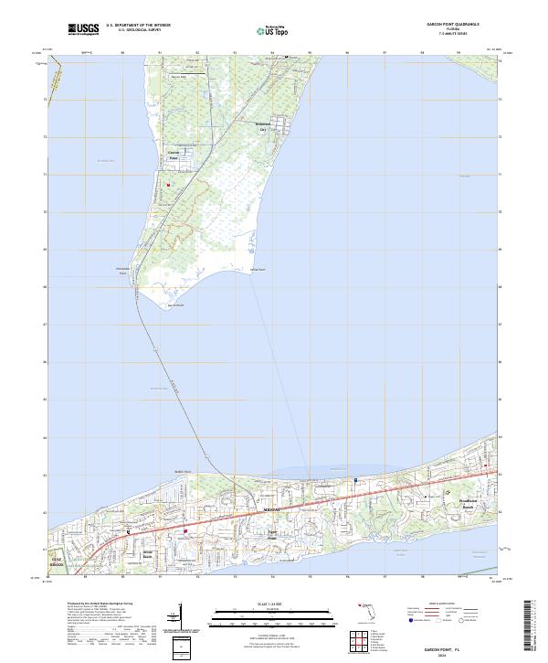
2024 Map of Garcon Point
USGS Topo · Published 2024About this map
Garcon Point and the surrounding peninsula dominate this coastal landscape where Escambia Bay meets Pensacola Bay. This contemporary survey reflects the modern road networks that bridge these waters, specifically Avalon Blvd and Garcon Point Rd, which connect the isolated community of Dickerson City to the more densely settled southern shoreline. The southern corridor along Gulf Breeze Pkwy shows a string of coastal developments including Gulf Breeze, Oriole Beach, and Woodlawn Beach, contrasted by the protected natural acreage of the Gulf Islands National Seashore.
Find a feature on this map
29 named features on this map. Tap any name to fly to it.
Don’t see what you’re looking for? This feature index may not catch every label — zoom into the map to look around manually.
Map Details
Editions of this 2024 Garcon Point Map
This is the sole edition of this map. No revisions or reprints were ever made.
Historical Maps of Tiger Point Through Time
4 maps found