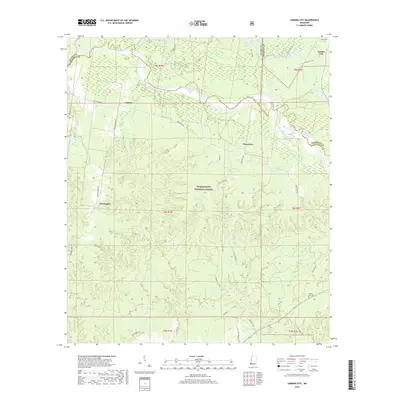
2018 Map of Garden City
USGS Topo · Published 2018About this map
The Homochitto River defines the northern reaches of this territory, where it carves through the southwestern corner of Mississippi. This landscape is a complex network of wetlands and drainage basins, notably featuring Belmont Slough and numerous oxbow formations like Pipe Lake and Delta Lake. The rugged geography is largely contained within the Homochitto National Forest, which spans across the borders of Adams, Franklin, and Wilkinson Counties. Small rural settlements are scattered along local routes, including Garden City and Perrytown. Local historians can find evidence of early community life at Mack Cem near the northern boundary and Homer Hill Cem to the southeast. The drainage patterns of Siloam Bayou and Turkey Cr demonstrate the hydrologic character of this timbered region, where secondary roads like Perrytown Rd and Garden City Rd provide the primary connections between isolated homesteads.
Find a feature on this map
44 named features on this map. Tap any name to fly to it.
Don’t see what you’re looking for? This feature index may not catch every label — zoom into the map to look around manually.
Map Details
Editions of this 2018 Garden City Map
This is the sole edition of this map. No revisions or reprints were ever made.
Other maps of this area

1936 · Woodville
USGS Topo · 1:62,500

1939 · Kingston
USGS Topo · 1:62,500

1953 · Natchez
USGS Topo · 1:250,000

1956 · Natchez
USGS Topo · 1:250,000

1958 · Woodville
USGS Topo · 1:62,500

1958 · Kingston
USGS Topo · 1:62,500

1959 · Natchez
USGS Topo · 1:250,000

1961 · Crosby
USGS Topo · 1:62,500

1961 · Gloster
USGS Topo · 1:62,500

1984 · Woodville
USGS Topo · 1:100,000