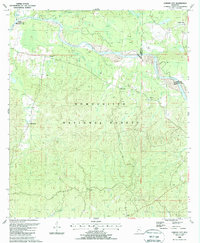
1988 Map of Garden City
USGS Topo · Published 1988About this map
The Homochitto River meanders across this landscape of the Homochitto National Forest, where the borders of Adams, Wilkinson, and Franklin counties converge. By the late 1980s, the region retained its rural character, marked by small settlements like Garden City and Ireland. The land is heavily dissected by numerous drainages, including Beaver Bayou and Siloam Bayou, illustrating the complex hydrology of the Mississippi piney woods.
Find a feature on this map
32 named features on this map. Tap any name to fly to it.
Don’t see what you’re looking for? This feature index may not catch every label — zoom into the map to look around manually.
Map Details
Editions of this 1988 Garden City Map
2 editions found
Other maps of this area

1936 · Woodville
USGS Topo · 1:62,500

1939 · Kingston
USGS Topo · 1:62,500

1953 · Natchez
USGS Topo · 1:250,000

1956 · Natchez
USGS Topo · 1:250,000

1958 · Woodville
USGS Topo · 1:62,500

1958 · Kingston
USGS Topo · 1:62,500

1959 · Natchez
USGS Topo · 1:250,000

1961 · Crosby
USGS Topo · 1:62,500

1961 · Gloster
USGS Topo · 1:62,500

1984 · Woodville
USGS Topo · 1:100,000