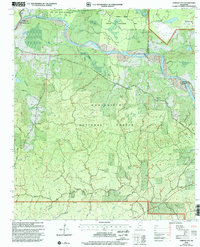
2000 Map of Garden City
USGS Topo · Published 2002About this map
Homochitto National Forest dominates the terrain of this quadrangle, where the Homochitto River meanders through the southern Mississippi landscape. Small settlements and crossroads like Garden City, Perrytown, and Darrington serve as the primary human anchors among the dense creek networks. The map shows a region defined by its water and conservation history, featuring the Sandy Creek Wildlife Management Area and numerous drainage systems including Beaver Creek and Silver Creek. Cultural markers are preserved through several Cem locations and rural assembly points like Perrytown Ch and Hopewell Ch. Significant topographic features such as Buffalo Lookout and the presence of numerous pipelines indicate the intersection of natural resource management and infrastructure in this part of Wilkinson and Adams Counties.
Find a feature on this map
47 named features on this map. Tap any name to fly to it.
Don’t see what you’re looking for? This feature index may not catch every label — zoom into the map to look around manually.
Map Details
Editions of this 2000 Garden City Map
This is the sole edition of this map. No revisions or reprints were ever made.
Other maps of this area

1936 · Woodville
USGS Topo · 1:62,500

1939 · Kingston
USGS Topo · 1:62,500

1953 · Natchez
USGS Topo · 1:250,000

1956 · Natchez
USGS Topo · 1:250,000

1958 · Woodville
USGS Topo · 1:62,500

1958 · Kingston
USGS Topo · 1:62,500

1959 · Natchez
USGS Topo · 1:250,000

1961 · Crosby
USGS Topo · 1:62,500

1961 · Gloster
USGS Topo · 1:62,500

1984 · Woodville
USGS Topo · 1:100,000