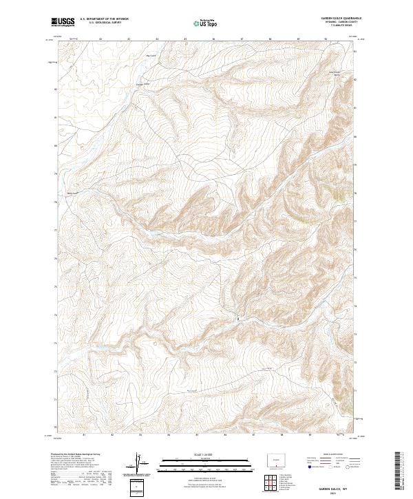
2021 Map of Garden Gulch
USGS Topo · Published 2021About this map
Cow Creek Butte anchors the northeastern corner of this drainage-rich portion of Carbon County, where intricate watercourses carve through the Wyoming high country. This modern survey illustrates a landscape primarily defined by its hydrography, with Garden Gulch and Hay Gulch cutting through the northern reaches. The presence of Wild Cow Rd provides a primary point of access across the southern terrain, shadowing the path of Wild Cow Cr and the S Fork Wild Cow Cr. These features, along with Deep Gulch and Cherokee Cr, demonstrate the complex erosion patterns typical of the region's western slopes. For researchers or land managers, the map provides precise section and township lines, including t16n r91w and t15n r90w, which are essential for identifying specific tracts of land and historic grazing or mining claims.
Find a feature on this map
13 named features on this map. Tap any name to fly to it.
Don’t see what you’re looking for? This feature index may not catch every label — zoom into the map to look around manually.
Map Details
Editions of this 2021 Garden Gulch Map
This is the sole edition of this map. No revisions or reprints were ever made.
Other maps of this area

1932 · Savery
USGS Topo · 1:96,000

1940 · Savery
USGS Topo · 1:125,000

1954 · Rawlins
USGS Topo · 1:250,000

1957 · Baggs
USGS Topo · 1:62,500

1957 · Doty Mountain
USGS Topo · 1:62,500

1958 · Rawlins
USGS Topo · 1:250,000
1961 · Browns Hill
USGS Topo · 1:24,000

1961 · Ketchum Buttes
USGS Topo · 1:24,000

1961 · Pole Gulch
USGS Topo · 1:24,000

1962 · Rawlins
USGS Topo · 1:250,000