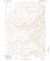
1982 Map of Garden Gulch
USGS Topo · Published 1983About this map
The J O Ranch stands as a focal point of human activity in this corner of the Wyoming high country, where the landscape is defined by the drainage systems of Cow Creek and Wild Cow Creek. The map reveals a complex network of resource extraction and water management, evidenced by numerous Drill Holes and Gas Wells interspersed with natural features like Hay Gulch and Garden Gulch. This interplay between ranching and the energy industry is typical of Carbon County's development during the late 1970s and early 1980s.
Find a feature on this map
18 named features on this map. Tap any name to fly to it.
Don’t see what you’re looking for? This feature index may not catch every label — zoom into the map to look around manually.
Map Details
Editions of this 1982 Garden Gulch Map
This is the sole edition of this map. No revisions or reprints were ever made.
Other maps of this area

1932 · Savery
USGS Topo · 1:96,000

1940 · Savery
USGS Topo · 1:125,000

1954 · Rawlins
USGS Topo · 1:250,000

1957 · Baggs
USGS Topo · 1:62,500

1957 · Doty Mountain
USGS Topo · 1:62,500

1958 · Rawlins
USGS Topo · 1:250,000
1961 · Browns Hill
USGS Topo · 1:24,000

1961 · Ketchum Buttes
USGS Topo · 1:24,000

1961 · Pole Gulch
USGS Topo · 1:24,000

1962 · Rawlins
USGS Topo · 1:250,000