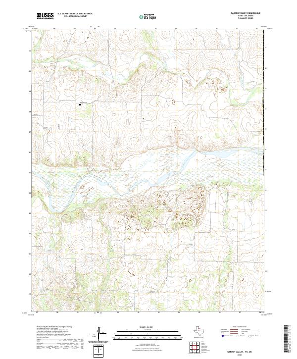
2022 Map of Garden Valley
USGS Topo · Published 2022About this map
The Prairie Dog Town Fork Red River dominates the central landscape of this section of Childress County, carving a wide, braided path through the north Texas plains. To the north, the isolated Olympus Cem serves as a lone genealogical marker amidst a network of rural routes like Co RD 19 and Co RD L. The terrain is defined by the drainage of several northern tributaries, including Buck Cr, Setters Cr, and Soldiers Cr, which flow toward the primary river valley. South of the river, the landscape transition is marked by Fm 1033 and a series of section-line roads, illustrating the organized grid of the Texas Panhandle's ranching and agricultural heartland.
Find a feature on this map
22 named features on this map. Tap any name to fly to it.
Don’t see what you’re looking for? This feature index may not catch every label — zoom into the map to look around manually.
Map Details
Editions of this 2022 Garden Valley Map
This is the sole edition of this map. No revisions or reprints were ever made.
Other maps of this area

1954 · Plainview
USGS Topo · 1:250,000

1955 · Lawton
USGS Topo · 1:250,000

1958 · Plainview
USGS Topo · 1:250,000

1960 · Goodlett
USGS Topo · 1:62,500

1960 · Loco
USGS Topo · 1:62,500

1961 · Hollis
USGS Topo · 1:62,500

1967 · Kirkland North
USGS Topo · 1:24,000

1967 · Childress
USGS Topo · 1:24,000
1975 · Hollis NW
USGS Topo · 1:24,000
1984 · Arlie
USGS Topo · 1:24,000