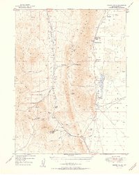
1951 Map of Garden Valley
USGS Topo · Published 1951About this map
The Sulphur Spring Range dominates this mid-century central Nevada landscape, separating the high valley basins of Garden Valley and Diamond Valley. The era’s ranching economy is clearly marked by several family-named operations, including Siri Ranch, Sadler Ranch, and Romano Ranch, which are clustered near reliable water sources like Shipley Hot Spring. The presence of the Diamond Valley School suggests a community hub for these dispersed ranching families.
Find a feature on this map
43 named features on this map. Tap any name to fly to it.
Don’t see what you’re looking for? This feature index may not catch every label — zoom into the map to look around manually.
Map Details
Editions of this 1951 Garden Valley Map
2 editions found
Other maps of this area

1926 · Roberts Mountains
USGS Topo · 1:250,000

1929 · Roberts Mountains
USGS Topo · 1:250,000

1934 · Jiggs
USGS Topo · 1:125,000

1937 · Mineral Hill
USGS Topo · 1:48,000

1937 · Jiggs
USGS Topo · 1:125,000

1943 · Mineral Hill
USGS Topo · 1:62,500

1949 · Garden Valley
USGS Topo · 1:62,500

1949 · Roberts Creek Mtn
USGS Topo · 1:62,500

1951 · Roberts Creek Mtn
USGS Topo · 1:62,500

1951 · Garden Valley
USGS Topo · 1:62,500