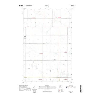
2020 Map of Gardena
USGS Topo · Published 2020About this map
Gardena stands as the primary settlement in this corner of the Great Plains, situated at the crossroads of 10th Ave NE and 89th St NE. The landscape is defined by the subtle drainage patterns of Oak Cr and Willow Cr, which weave through a grid of section lines and rural townships. For those tracing local history, the map preserves the locations of the Gardena Methodist Cem and the Evangelical Cem, positioned south and east of the main townsite. The transition from Bottineau Co into McHenry Co at the southern edge of the survey highlights the administrative boundaries that have shaped land ownership and development in this agricultural region since its early settlement.
Find a feature on this map
34 named features on this map. Tap any name to fly to it.
Don’t see what you’re looking for? This feature index may not catch every label — zoom into the map to look around manually.
Map Details
Editions of this 2020 Gardena Map
This is the sole edition of this map. No revisions or reprints were ever made.
Other maps of this area

1950 · Upham SE
USGS Topo · 1:24,000

1950 · Willow City SW
USGS Topo · 1:24,000

1954 · Omemee
USGS Topo · 1:24,000

1954 · Souris SE
USGS Topo · 1:24,000

1954 · Gardena
USGS Topo · 1:24,000

1954 · Willow City
USGS Topo · 1:24,000

1954 · Minot
USGS Topo · 1:250,000
1955 · Upham NE
USGS Topo · 1:24,000

1955 · Bottineau
USGS Topo · 1:24,000

1955 · Bottineau SE
USGS Topo · 1:24,000