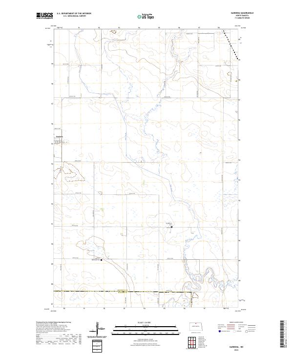
2024 Map of Gardena
USGS Topo · Published 2024About this map
Gardena and the surrounding prairie of northern North Dakota are defined by a grid-like network of rural roads and the winding paths of Oak Creek and Willow Creek. This landscape at the border of Bottineau Co and McHenry Co reflects a long history of agricultural settlement. Local genealogy and community roots are anchored by the Gardena Methodist Cem south of town and the Evangelical Cem further east. The map shows a clear division of land into townships such as t160n r76w and t160n r75w, where the intersection of 86th St NE and 13th Ave NE serves as a local waypoint. The presence of numerous small wetlands across the terrain suggests the glacial legacy of this region, remaining largely unchanneled as they collect around the slow-moving creek beds.
Find a feature on this map
33 named features on this map. Tap any name to fly to it.
Don’t see what you’re looking for? This feature index may not catch every label — zoom into the map to look around manually.
Map Details
Editions of this 2024 Gardena Map
This is the sole edition of this map. No revisions or reprints were ever made.
Other maps of this area

1950 · Upham SE
USGS Topo · 1:24,000

1950 · Willow City SW
USGS Topo · 1:24,000

1954 · Omemee
USGS Topo · 1:24,000

1954 · Souris SE
USGS Topo · 1:24,000

1954 · Gardena
USGS Topo · 1:24,000

1954 · Willow City
USGS Topo · 1:24,000

1954 · Minot
USGS Topo · 1:250,000
1955 · Upham NE
USGS Topo · 1:24,000

1955 · Bottineau
USGS Topo · 1:24,000

1955 · Bottineau SE
USGS Topo · 1:24,000