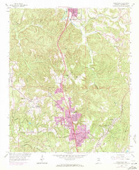
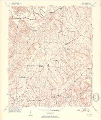
1959 Map of Gardendale
USGS Topo · Published 1971About this map
Gardendale and surrounding Jefferson County communities show a period of post-war expansion and industrial activity along the Louisville and Nashville railroad corridor. The landscape is shaped by the transition from rural mining and farming roots to suburban growth, with newer urban extensions highlighted alongside traditional landmarks like Snow Roberts Sch and the New Castle Community House. Significant coal-related infrastructure is evident at New Castle and the Moncrief Gem, while the topography is defined by the winding course of Turkey Creek and the prominent Easterwood Mtn. Numerous country churches, including Pineywood Ch and Shady Grove Ch, serve as anchors for established neighborhoods such as Fieldstown and Mt Olive.
Find a feature on this map
43 named features on this map. Tap any name to fly to it.
Don’t see what you’re looking for? This feature index may not catch every label — zoom into the map to look around manually.
Map Details
Editions of this 1959 Gardendale Map
4 editions found
Other maps of this area

1889 · Birmingham
USGS Topo · 1:125,000

1892 · Birmingham
USGS Topo · 1:125,000

1895 · Birmingham
USGS Topo · 1:125,000

1904 · Birmingham Coal District
USGS Topo · 1:62,500

1905 · Leeds
USGS Topo · 1:62,500

1906 · Birmingham Special
USGS Topo · 1:62,500

1907 · Birmingham
USGS Topo · 1:125,000

1907 · Leeds
USGS Topo · 1:62,500

1951 · Warrior
USGS Topo · 1:24,000
1951 · Creel
USGS Topo · 1:24,000