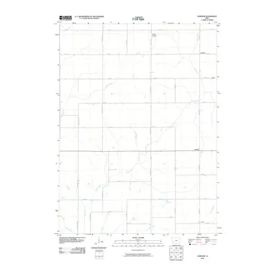
2010 Map of Gardner
USGS Topo · Published 2010About this map
Davids Creek meanders through this agricultural landscape, anchoring a network of rural settlements in Audubon County. The map documents the persistent layout of farming communities such as Gardner, Larland, Melville, and Conkling, which are linked by a precise grid of gravel and dirt roads. These thoroughfares, named after birds and local landmarks like Nighthawk Ave and Robin Ave, define the township's organization during the early 21st century.
Find a feature on this map
26 named features on this map. Tap any name to fly to it.
Don’t see what you’re looking for? This feature index may not catch every label — zoom into the map to look around manually.
Map Details
Editions of this 2010 Gardner Map
This is the sole edition of this map. No revisions or reprints were ever made.
Other maps of this area

1954 · Omaha
USGS Topo · 1:250,000

1957 · Omaha
USGS Topo · 1:250,000

1957 · Audubon
USGS Topo · 1:62,500

1958 · Omaha
USGS Topo · 1:250,000

1971 · Coon Rapids South
USGS Topo · 1:24,000

1971 · Viola Center
USGS Topo · 1:24,000

1971 · North Branch
USGS Topo · 1:24,000

1971 · Gray
USGS Topo · 1:24,000
1971 · Adair North
USGS Topo · 1:24,000
1983 · Exira West
USGS Topo · 1:24,000