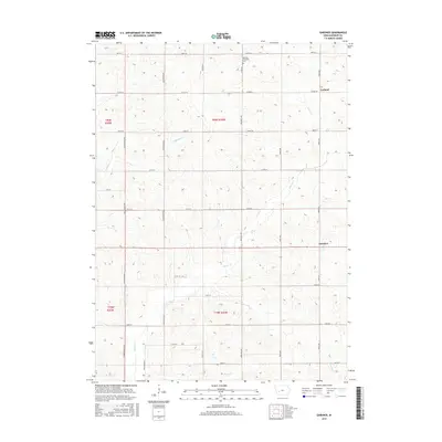
2015 Map of Gardner
USGS Topo · Published 2015About this map
Melville Township Cem sits along Co Rd N36 in the northern reaches of this Audubon County landscape, representing a central anchor for local genealogy. The terrain is defined by a dendritic drainage pattern where Crabapple Cr and Davids Cr wind through the sections, eventually giving way to Honey Cr and Fourmile Cr in the south. These waterways dictate the rolling topography of the Missouri River basin, creating the textured elevation profile characteristic of the region.
Find a feature on this map
30 named features on this map. Tap any name to fly to it.
Don’t see what you’re looking for? This feature index may not catch every label — zoom into the map to look around manually.
Map Details
Editions of this 2015 Gardner Map
This is the sole edition of this map. No revisions or reprints were ever made.
Other maps of this area
1954 · Omaha
USGS Topo · 1:250,000
1957 · Omaha
USGS Topo · 1:250,000
1957 · Audubon
USGS Topo · 1:62,500
1958 · Omaha
USGS Topo · 1:250,000
1971 · Coon Rapids South
USGS Topo · 1:24,000
1971 · Viola Center
USGS Topo · 1:24,000
1971 · North Branch
USGS Topo · 1:24,000
1971 · Gray
USGS Topo · 1:24,000
1971 · Adair North
USGS Topo · 1:24,000
1983 · Exira West
USGS Topo · 1:24,000