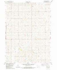
1983 Map of Gardner
USGS Topo · Published 1984About this map
The agrarian landscape of Audubon County in the early 1980s is defined by the rolling divides of Melville and Greeley townships. The map documents the small rural clusters of Gardner and Larland, connected by a network of sectional roads and the curving paths of Davids Creek and Crabapple Creek. This survey captures the region during a period of established mid-century agricultural patterns, where family farms were punctuated by local landmarks like the Township Cem and a prominent Radio Tower. Fine red dashed lines throughout the map provide an extra layer of detail, showing field and fence lines interpreted from aerial photography. This provides local historians with a precise record of land use and boundary divisions before modern industrial farming further consolidated these plots.
Find a feature on this map
12 named features on this map. Tap any name to fly to it.
Don’t see what you’re looking for? This feature index may not catch every label — zoom into the map to look around manually.
Map Details
Editions of this 1983 Gardner Map
This is the sole edition of this map. No revisions or reprints were ever made.
Other maps of this area

1954 · Omaha
USGS Topo · 1:250,000

1957 · Omaha
USGS Topo · 1:250,000

1957 · Audubon
USGS Topo · 1:62,500

1958 · Omaha
USGS Topo · 1:250,000

1971 · Coon Rapids South
USGS Topo · 1:24,000

1971 · Viola Center
USGS Topo · 1:24,000

1971 · North Branch
USGS Topo · 1:24,000

1971 · Gray
USGS Topo · 1:24,000
1971 · Adair North
USGS Topo · 1:24,000
1983 · Exira West
USGS Topo · 1:24,000