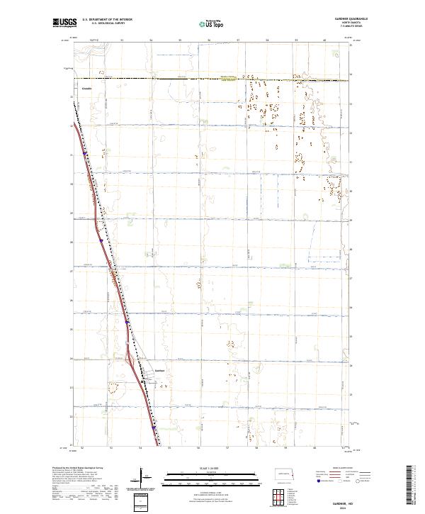
2024 Map of Gardner
USGS Topo · Published 2024About this map
The agricultural plains at the border of Traill County and Cass County are defined by a strict section-line grid of rural roads and the north-south corridor of a major highway. The settlement of Gardner serves as a focal point in the southern portion of the map, situated along a primary transportation route and home to the Gardner Cem. Further north, the town of Grandin sits just below the county line, marking another node in this sparsely populated farming landscape. This 2024 survey captures the region's enduring rural character, where local connectors like Co Rd 2 and Cty Rd 26 link isolated homesteads and grain-handling facilities to the larger regional network. The terrain is characterized by intricate drainage patterns and wetlands that weave through the surveyed townships, including t143n r50w and t144n r49w.
Find a feature on this map
24 named features on this map. Tap any name to fly to it.
Don’t see what you’re looking for? This feature index may not catch every label — zoom into the map to look around manually.
Map Details
Editions of this 2024 Gardner Map
This is the sole edition of this map. No revisions or reprints were ever made.
Other maps of this area

1918 · Kelso
USGS Topo · 1:62,500

1918 · Hendrum
USGS Topo · 1:62,500

1943 · Kelso
USGS Topo · 1:62,500

1952 · Grand Forks
USGS Topo · 1:250,000

1956 · Grand Forks
USGS Topo · 1:250,000

1963 · Georgetown
USGS Topo · 1:24,000
1963 · Argusville
USGS Topo · 1:24,000

1963 · Perley
USGS Topo · 1:24,000

1963 · Gardner
USGS Topo · 1:24,000

1963 · Halstad
USGS Topo · 1:24,000