2024 Map of Gardner
USGS Topo · Published 2024About this map
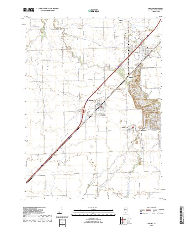
Gardner and South Wilmington anchor a landscape defined by the convergence of several waterways in Grundy County. The West Fork Mazon River and the Mazon River wind through the terrain, joined by smaller tributaries like Gooseberry Creek and Granary Creek. This modern survey reveals a highly organized grid of rural roads and state routes that connect long-established communities such as Braceville, East Brooklyn, and Godley. To the north, the periphery of Coal City is visible, reflecting the industrial heritage of this portion of Illinois. Local history is grounded in specific sites like Cotton Cem and the small settlement of Mazonia, while the presence of a Po in Gardner highlights its role as a regional hub. The map provides a contemporary view of the intersection between these small prairie towns and the natural drainage patterns of the Illinois river valleys.
Find a feature on this map
81 named features on this map. Tap any name to fly to it.
Don’t see what you’re looking for? This feature index may not catch every label — zoom into the map to look around manually.
Map Details
Editions of this 2024 Gardner Map
This is the sole edition of this map. No revisions or reprints were ever made.