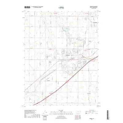
2018 Map of Gardner
USGS Topo · Published 2018About this map
Gardner and Edgerton anchor this Johnson County landscape, illustrating the modern intersection of aviation and residential expansion. The presence of both the New Century Aircenter and Gardner Municipal Airport highlights the region's role as a logistical hub, while a network of cemeteries like Four Corners Cem and Saint Columbia Cem provide reference points for local genealogy. This 2018 survey traces the drainage patterns of Kill Cr and Bull Cr, which navigate between a dense grid of township roads and emerging suburban developments. The map documents the persistent agricultural grid, defined by routes like W 175th St and W 191st St, even as residential streets begin to fill the spaces between historic family cemeteries like Fuller Cem and Saint Columbine Cem.
Find a feature on this map
61 named features on this map. Tap any name to fly to it.
Don’t see what you’re looking for? This feature index may not catch every label — zoom into the map to look around manually.
Map Details
Editions of this 2018 Gardner Map
This is the sole edition of this map. No revisions or reprints were ever made.
Other maps of this area

1885 · Lawrence
USGS Topo · 1:125,000

1887 · Olathe
USGS Topo · 1:125,000

1889 · Lawrence
USGS Topo · 1:125,000

1893 · Olathe
USGS Topo · 1:125,000

1935 · Olathe
USGS Topo · 1:24,000

1943 · Olathe
USGS Topo · 1:31,680

1947 · Lawrence
USGS Topo · 1:250,000

1950 · Lawrence
USGS Topo · 1:250,000

1951 · De Soto
USGS Topo · 1:24,000
1951 · Eudora
USGS Topo · 1:24,000