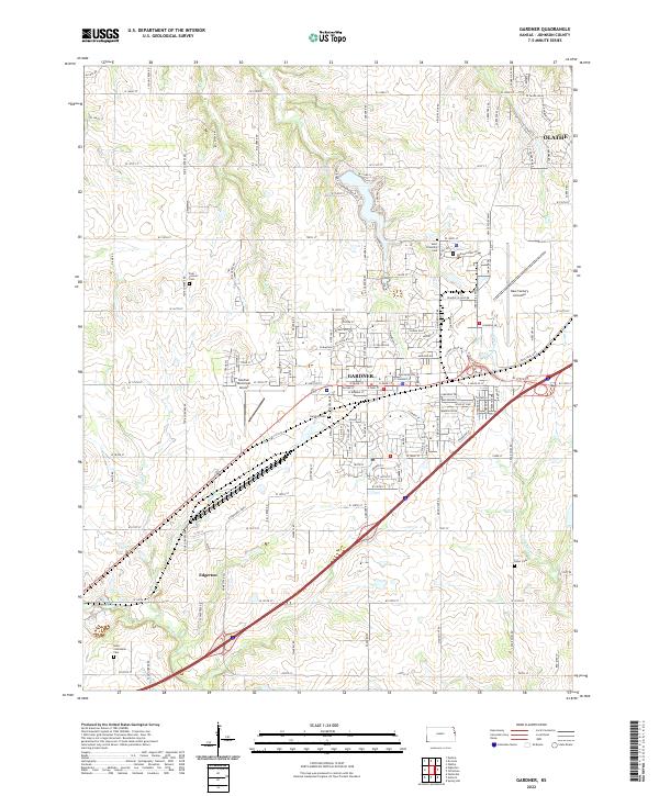
2022 Map of Gardner
USGS Topo · Published 2022About this map
Gardner and Edgerton serve as the primary hubs in this portion of Johnson County, where the transition from suburban expansion to traditional Kansas agricultural land is clearly visible. The landscape is defined by the drainage systems of Kill Cr and Little Bull Cr, which cut through the terrain south of the burgeoning developments in Olathe. For local historians and genealogists, the map identifies several significant burial sites, including Four Corners Cem and Gardner Cem, alongside the Saint Columbine Cem further south. Aviation infrastructure is a prominent feature of the area's modern identity, with both the Gardner Municipal Airport and the expansive New Century Aircenter occupying large tracts of land. These facilities, combined with the dense network of county roads like Four Corners Rd and Kill Creek Rd, illustrate the area's role as a transportation corridor connecting the smaller towns to the greater metropolitan region.
Find a feature on this map
130 named features on this map. Tap any name to fly to it.
Don’t see what you’re looking for? This feature index may not catch every label — zoom into the map to look around manually.
Map Details
Editions of this 2022 Gardner Map
This is the sole edition of this map. No revisions or reprints were ever made.
Other maps of this area

1885 · Lawrence
USGS Topo · 1:125,000

1887 · Olathe
USGS Topo · 1:125,000

1889 · Lawrence
USGS Topo · 1:125,000

1893 · Olathe
USGS Topo · 1:125,000

1935 · Olathe
USGS Topo · 1:24,000

1943 · Olathe
USGS Topo · 1:31,680

1947 · Lawrence
USGS Topo · 1:250,000

1950 · Lawrence
USGS Topo · 1:250,000

1951 · De Soto
USGS Topo · 1:24,000
1951 · Eudora
USGS Topo · 1:24,000