
1956 Map of Gardner
USGS Topo · Published 1956About this map
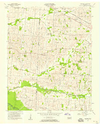
Gardner and Mount Pelia anchor this agricultural landscape along the Obion Co Weakley Co line during the mid-1950s. The settlement pattern is defined by a dense network of family cemeteries and rural congregations, reflecting a deeply rooted community structure. Churches such as Harmony Ch, New Home Ch, and Alamo Ch are spaced at regular intervals, often adjacent to named burial grounds like Shaddtown Cem and McKinney Cem. The northern portion of the map is dominated by the Nashville Chattanooga and St Louis railway, which parallels Cypress Creek. To the south, the terrain descends toward the bottomlands of the South Fork Obion River and Mud Creek, where the Beech Grove Ch and various family plots like Hall Cem dot the landscape. This survey captures a moment when small rural hubs like the Stella Ruth Community Center served as vital social anchors for the surrounding farmsteads.
Find a feature on this map
34 named features on this map. Tap any name to fly to it.
Don’t see what you’re looking for? This feature index may not catch every label — zoom into the map to look around manually.
Map Details
Editions of this 1956 Gardner Map
3 editions found
Other maps of this area

1950 · Martin
USGS Topo · 1:24,000

1950 · Rives
USGS Topo · 1:24,000

1951 · Rives
USGS Topo · 1:24,000

1954 · Rutherford
USGS Topo · 1:24,000

1954 · Greenfield
USGS Topo · 1:24,000

1954 · Union City
USGS Topo · 1:24,000

1956 · Harris
USGS Topo · 1:24,000

1956 · Mc Connell
USGS Topo · 1:24,000

1956 · Dyersburg
USGS Topo · 1:250,000
1965 · Kenton
USGS Topo · 1:24,000