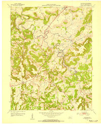
1953 Map of Garfield
USGS Topo · Published 1955About this map
Sinking Creek carves a winding, serpentine path through this Breckinridge County landscape, dictating the placement of early infrastructure and settlements. The Louisville and Nashville railroad serves the northern hub of Irvington, while the southern reaches are dominated by high ridges like Pilot Ridge and Burning Ridge. The terrain is notably dense with family-named burial grounds, such as Whitworth Cem and Shumate Cem, suggesting a long-established rural community pattern where small homesteads were anchored to the local topography.
Find a feature on this map
31 named features on this map. Tap any name to fly to it.
Don’t see what you’re looking for? This feature index may not catch every label — zoom into the map to look around manually.
Map Details
Editions of this 1953 Garfield Map
2 editions found
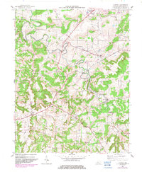
Other maps of this area

1928 · Hardinsburg
USGS Topo · 1:48,000

1931 · Hardinsburg
USGS Topo · 1:62,500

1932 · Big Clifty
USGS Topo · 1:62,500

1941 · Ekron
USGS Topo · 1:62,500

1947 · Irvington
USGS Topo · 1:24,000

1947 · Lodiburg
USGS Topo · 1:24,000

1947 · Hardinsburg
USGS Topo · 1:24,000

1947 · Garfield
USGS Topo · 1:24,000

1947 · Hardinsburg
USGS Topo · 1:62,500

1947 · Ekron
USGS Topo · 1:62,500