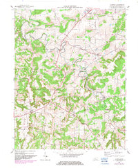
1953 Map of Garfield
USGS Topo · Published 1982About this map
Irvington anchors the northern portion of this Breckinridge County landscape, where the Louisville and Nashville railroad cuts a straight line through the rolling karst topography. The area is defined by the winding course of Sinking Creek, which disappears and reappears through the terrain, flanked by significant elevations like Sinking Creek Hill and Pilot Ridge. Small rural crossroads and hamlets such as Garfield, Rosetta, and Stinnettsville serve as focal points for a farming community interconnected by a network of local roads and a prominent pipe line. Family history is deeply etched into the land, evidenced by numerous small burial grounds including the Whitworth Cem, Marr Cem, and Shumate Cem. A mid-century Drive-in Theatre near the northern edge of the map provides a glimpse into the local social life and recreation of the early 1950s.
Find a feature on this map
35 named features on this map. Tap any name to fly to it.
Don’t see what you’re looking for? This feature index may not catch every label — zoom into the map to look around manually.
Map Details
Editions of this 1953 Garfield Map
2 editions found
Other maps of this area

1928 · Hardinsburg
USGS Topo · 1:48,000

1931 · Hardinsburg
USGS Topo · 1:62,500

1932 · Big Clifty
USGS Topo · 1:62,500

1941 · Ekron
USGS Topo · 1:62,500

1947 · Irvington
USGS Topo · 1:24,000

1947 · Lodiburg
USGS Topo · 1:24,000

1947 · Hardinsburg
USGS Topo · 1:24,000

1947 · Garfield
USGS Topo · 1:24,000

1947 · Hardinsburg
USGS Topo · 1:62,500

1947 · Ekron
USGS Topo · 1:62,500