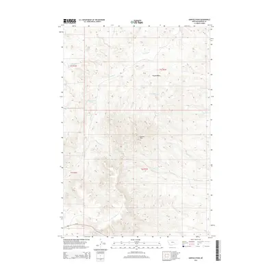
2014 Map of Garfield Peak
USGS Topo · Published 2014About this map
Garfield Peak rises as a prominent landmark in this section of Rosebud County, serving as a focal point for a complex network of drainages and seasonal water sources. The landscape is defined by its watershed geography, where Greenleaf Cr, Lay Cr, and Hollowbreast Cr carve into the terrain. A notable human mark on the land is the Wood Place, situated near the headwaters of Lay Cr, suggesting a history of ranching or remote habitation in this drainage-rich environment. To the south, Reservation Cr and Cow Cr flow toward the lower reaches of the quadrangle, while Fields Reservoir in the northeast indicates managed water resources in an otherwise semi-arid stretch. The presence of numerous named springs, such as 61S43E34BCBC01 Spring, further underscores the importance of reliable water for land use in this part of Montana.
Find a feature on this map
25 named features on this map. Tap any name to fly to it.
Don’t see what you’re looking for? This feature index may not catch every label — zoom into the map to look around manually.
Map Details
Editions of this 2014 Garfield Peak Map
This is the sole edition of this map. No revisions or reprints were ever made.
Other maps of this area

1954 · Hardin
USGS Topo · 1:250,000

1957 · Hardin
USGS Topo · 1:250,000

1958 · Hardin
USGS Topo · 1:250,000

1958 · Garfield Peak
USGS Topo · 1:24,000

1958 · Fisher Butte
USGS Topo · 1:24,000

1958 · Badger Peak
USGS Topo · 1:24,000

1958 · Hollowwood Creek
USGS Topo · 1:24,000

1966 · Ashland
USGS Topo · 1:24,000

1966 · Ashland NE
USGS Topo · 1:24,000

1971 · Colstrip SE
USGS Topo · 1:24,000