
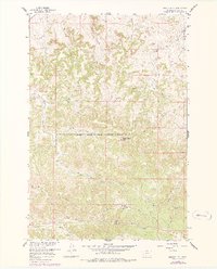
1958 Map of Badger Peak
USGS Topo · Published 1960About this map
Northern Cheyenne Indian Reservation Boundary cuts through this high-altitude landscape in Rosebud County, separating the reservation lands from the surrounding terrain. The topography is dominated by dramatic elevations like Badger Peak and Charlie Black Butte, which overlook a network of seasonal drainages and coulees. Water sources are critical identifiers in this environment, with named features such as Ice Well, Diamond R Spring, and Yellow Fox Spring providing vital points of reference for ranching or surveying operations.
Find a feature on this map
24 named features on this map. Tap any name to fly to it.
Don’t see what you’re looking for? This feature index may not catch every label — zoom into the map to look around manually.
Map Details
Editions of this 1958 Badger Peak Map
2 editions found
Other maps of this area

1954 · Hardin
USGS Topo · 1:250,000

1957 · Hardin
USGS Topo · 1:250,000

1958 · Hardin
USGS Topo · 1:250,000

1958 · Garfield Peak
USGS Topo · 1:24,000

1958 · Jimtown
USGS Topo · 1:24,000

1958 · Fisher Butte
USGS Topo · 1:24,000

1958 · Lame Deer
USGS Topo · 1:24,000

1958 · Hollowwood Creek
USGS Topo · 1:24,000

1971 · Colstrip SW
USGS Topo · 1:24,000

1971 · Colstrip SE
USGS Topo · 1:24,000