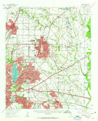
1959 Map of Garland
USGS Topo · Published 1963About this map
Garland and its neighboring eastern Dallas County communities appear during a period of rapid suburban expansion, still set against a landscape defined by the East Fork Trinity River and White Rock Lake. The map reveals a transition from rural farmland to residential grids, where old family-named landmarks like Blewett Cem and Miles Cem sit near newly established school campuses such as Adams High Sch and Richardson High Sch. Transportation networks are heavily represented by the Gulf Colorado and Santa Fe RR and the Missouri Kansas and Texas RR, which historically anchored the growth of Richardson and Mesquite. Notable local institutions including the East Buckner Orphans Home and the Eastern Hills Country Club provide clear markers of the era's social and community layout. The presence of numerous gravel pits and specialized landing strips like Garland Airport reflects the mid-century industrial and aviation activity that shaped the region before it was fully enveloped by the modern metroplex.
Find a feature on this map
116 named features on this map. Tap any name to fly to it.
Don’t see what you’re looking for? This feature index may not catch every label — zoom into the map to look around manually.
Map Details
Editions of this 1959 Garland Map
This is the sole edition of this map. No revisions or reprints were ever made.
Other maps of this area

1891 · Dallas
USGS Topo · 1:125,000

1893 · Dallas
USGS Topo · 1:125,000

1912 · Rockwall
USGS Topo · 1:31,680

1919 · Royse City
USGS Topo · 1:62,500

1924 · Farmersville 3-c
USGS Topo · 1:48,000

1924 · Mc Kinney 4-d
USGS Topo · 1:48,000

1929 · Frisco
USGS Topo · 1:62,500

1929 · McKinney
USGS Topo · 1:62,500

1930 · Farmersville
USGS Topo · 1:62,500

1931 · Carrollton
USGS Topo · 1:62,500