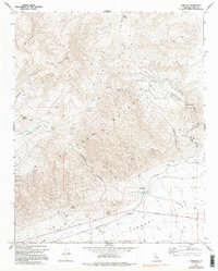
1967 Map of Garlock
USGS Topo · Published 1995About this map
The El Paso Mountains dominate this high-desert landscape in Kern County, revealing a mid-century terrain marked by prospecting and remote outposts. Settlement is concentrated in scattered mining camps such as Schmidt Camp, Gerbracht Camp, and Holland Camp, while the town of Garlock sits at the edge of the Fremont Valley. The presence of the Garlock Historical Marker near a cluster of wells highlights the area's significance in early California desert history.
Find a feature on this map
44 named features on this map. Tap any name to fly to it.
Don’t see what you’re looking for? This feature index may not catch every label — zoom into the map to look around manually.
Map Details
Editions of this 1967 Garlock Map
3 editions found
Other maps of this area

1903 · Randsburg
USGS Topo · 1:62,500

1911 · Randsburg
USGS Topo · 1:62,500

1912 · Randsburg
USGS Topo · 1:62,500

1915 · Searles Lake
USGS Topo · 1:250,000

1943 · Inyokern
USGS Topo · 1:62,500

1943 · Saltdale
USGS Topo · 1:62,500

1947 · Trona
USGS Topo · 1:250,000

1948 · Trona
USGS Topo · 1:250,000

1953 · Ridgecrest
USGS Topo · 1:62,500

1953 · Trona
USGS Topo · 1:250,000