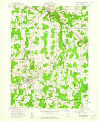
1959 Map of Garrettsville
USGS Topo · Published 1960About this map
Garrettsville serves as the focal point of this northeast Ohio landscape, situated at the junction of Eagle Creek and Silver Creek. The area within the Connecticut Western Reserve displays a mix of agricultural plots and dense woodland, particularly along the dramatic rock formations of Nelson Ledge State Park and Kennedy Ledge. These geological features are complemented by the local industrial footprint seen at Silica, where Sand & Rock Pits indicate the extraction of local natural resources.
Find a feature on this map
64 named features on this map. Tap any name to fly to it.
Don’t see what you’re looking for? This feature index may not catch every label — zoom into the map to look around manually.
Map Details
Editions of this 1959 Garrettsville Map
Other maps of this area

1905 · Bristolville
USGS Topo · 1:62,500

1905 · Garrettsville
USGS Topo · 1:62,500

1906 · Ravenna
USGS Topo · 1:62,500

1907 · Bristolville
USGS Topo · 1:62,500

1907 · Garrettsville
USGS Topo · 1:62,500

1908 · Warren
USGS Topo · 1:62,500

1908 · Ravenna
USGS Topo · 1:62,500

1950 · Cleveland
USGS Topo · 1:250,000

1952 · West Farmington
USGS Topo · 1:24,000

1952 · Southington
USGS Topo · 1:24,000