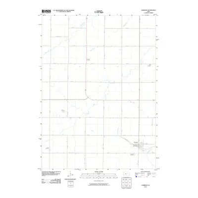
2010 Map of Garrison
USGS Topo · Published 2010About this map
Garrison serves as the primary hub for this agricultural portion of Benton County, defined by a rigid grid of section roads and the meandering courses of local waterways. The township layout is punctuated by a series of burial grounds that mark the heritage of early family farmsteads, including Fairview Cemetery, Urmy Cemetery, and Gnagy Cemetery. These landmarks provide significant data points for genealogists tracing local lineage back to the nineteenth-century settlement of the Iowa prairie.
Find a feature on this map
27 named features on this map. Tap any name to fly to it.
Don’t see what you’re looking for? This feature index may not catch every label — zoom into the map to look around manually.
Map Details
Editions of this 2010 Garrison Map
This is the sole edition of this map. No revisions or reprints were ever made.
Other maps of this area

1954 · Waterloo
USGS Topo · 1:250,000

1955 · Waterloo
USGS Topo · 1:250,000

1963 · Eagle Center
USGS Topo · 1:24,000
1971 · Elberon
USGS Topo · 1:24,000
1971 · Van Horne
USGS Topo · 1:24,000
1971 · Dysart
USGS Topo · 1:24,000

1971 · La Porte City
USGS Topo · 1:24,000
1971 · Vinton
USGS Topo · 1:24,000
1971 · Brandon
USGS Topo · 1:24,000
1971 · Garrison
USGS Topo · 1:24,000