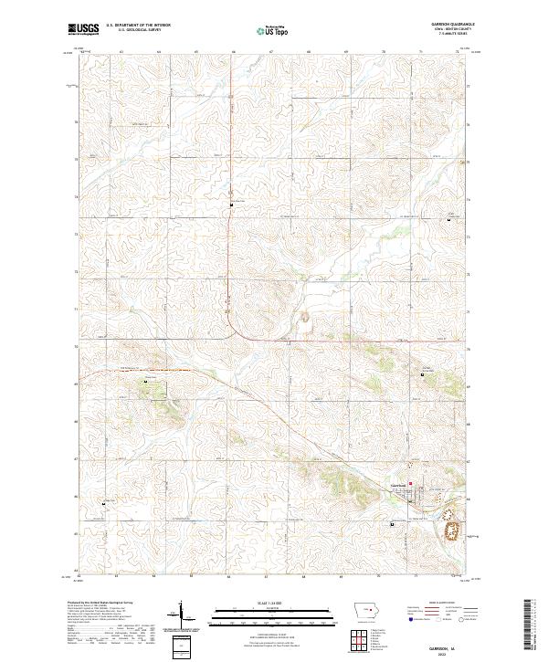
2022 Map of Garrison
USGS Topo · Published 2022About this map
Garrison serves as the primary hub of this Benton County landscape, situated where the rolling agricultural uplands meet the winding course of Hinkle Cr. The town's grid is bounded by a network of rural routes such as 60th Street Dr and Co Trunk Hwy E22, illustrating a classic Midwestern township structure. A notable modern conversion of historical transit is the Old Creamery Trl, which diagonals across the terrain from the northwest, cutting through sections t85n r12w and t85n r11w toward the settlement center.
Find a feature on this map
27 named features on this map. Tap any name to fly to it.
Don’t see what you’re looking for? This feature index may not catch every label — zoom into the map to look around manually.
Map Details
Editions of this 2022 Garrison Map
This is the sole edition of this map. No revisions or reprints were ever made.
Other maps of this area

1954 · Waterloo
USGS Topo · 1:250,000

1955 · Waterloo
USGS Topo · 1:250,000

1963 · Eagle Center
USGS Topo · 1:24,000
1971 · Elberon
USGS Topo · 1:24,000
1971 · Van Horne
USGS Topo · 1:24,000
1971 · Dysart
USGS Topo · 1:24,000

1971 · La Porte City
USGS Topo · 1:24,000
1971 · Vinton
USGS Topo · 1:24,000
1971 · Brandon
USGS Topo · 1:24,000
1971 · Garrison
USGS Topo · 1:24,000