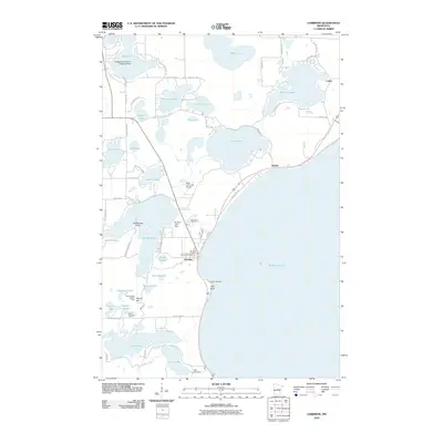
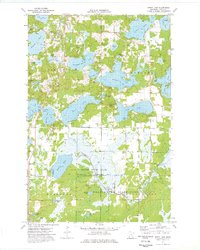
2010 Map of Garrison
USGS Topo · Published 2010About this map
Mille Lacs Lake dominates the southeastern horizon of this Crow Wing County landscape, where the settlement of Garrison serves as a focal point for the region's lakeside activity. The infrastructure of the early 21st century is well-established here, featuring the Garrison Post Office, a local golf course, and the Mille Lacs Lake Airport. Further north, smaller lakeside communities like Nichols and Cutler line the shores of Big Pine Lake, connected by a network of local routes such as County Hwy-10 and Tarrymore Rd.
Find a feature on this map
64 named features on this map. Tap any name to fly to it.
Don’t see what you’re looking for? This feature index may not catch every label — zoom into the map to look around manually.
Map Details
Editions of this 2010 Garrison Map
This is the sole edition of this map. No revisions or reprints were ever made.
Other maps of this area

1912 · Deerwood
USGS Topo · 1:62,500

1914 · Deerwood
USGS Topo · 1:62,500

1916 · Wealthwood
USGS Topo · 1:62,500

1953 · Duluth
USGS Topo · 1:250,000

1958 · Duluth
USGS Topo · 1:250,000

1968 · Onamia NW
USGS Topo · 1:24,000
1968 · Platte Lake
USGS Topo · 1:24,000
1968 · Vineland
USGS Topo · 1:24,000
1973 · Crosby
USGS Topo · 1:24,000
1973 · Spirit Lake
USGS Topo · 1:24,000