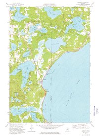
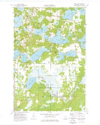
1973 Map of Garrison
USGS Topo · Published 1976About this map
Mille Lacs Lake and the western shore of St Albans Bay dominate the eastern half of this landscape, where the settlement of Garrison serves as a hub for lakeside activity. The map reveals a high concentration of recreational and community infrastructure along the shoreline, including a Drive-in Theater, a Fish Hatchery, and multiple public access points and marinas. Further inland, the terrain is defined by a dense network of smaller water bodies such as Round Lake, Big Pine Lake, and Borden Lake, which are interspersed with private camps like Camp Jacobsen.
Find a feature on this map
52 named features on this map. Tap any name to fly to it.
Don’t see what you’re looking for? This feature index may not catch every label — zoom into the map to look around manually.
Map Details
Editions of this 1973 Garrison Map
This is the sole edition of this map. No revisions or reprints were ever made.
Other maps of this area

1912 · Deerwood
USGS Topo · 1:62,500

1914 · Deerwood
USGS Topo · 1:62,500

1916 · Wealthwood
USGS Topo · 1:62,500

1953 · Duluth
USGS Topo · 1:250,000

1958 · Duluth
USGS Topo · 1:250,000

1968 · Onamia NW
USGS Topo · 1:24,000
1968 · Platte Lake
USGS Topo · 1:24,000
1968 · Vineland
USGS Topo · 1:24,000
1973 · Crosby
USGS Topo · 1:24,000
1973 · Spirit Lake
USGS Topo · 1:24,000