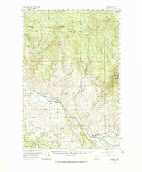
1958 Map of Garrison
USGS Topo · Published 1966About this map
Garrison and Goldcreek serve as the primary hubs of activity in this 1950s survey, situated where the Little Blackfoot River joins the Clark Fork. The valley floors are defined by the convergence of the Northern Pacific and the Chicago Milwaukee St Paul and Pacific railroads, reflecting the heavy industrial and logistical importance of this Powell County corridor.
Find a feature on this map
50 named features on this map. Tap any name to fly to it.
Don’t see what you’re looking for? This feature index may not catch every label — zoom into the map to look around manually.
Map Details
Editions of this 1958 Garrison Map
3 editions found

Other maps of this area

1889 · Helena
USGS Topo · 1:250,000

1893 · Helena
USGS Topo · 1:250,000

1899 · Helena
USGS Topo · 1:250,000

1903 · Helena
USGS Topo · 1:250,000

1908 · Philipsburg
USGS Topo · 1:125,000

1919 · Drummond
USGS Topo · 1:125,000

1921 · Drummond
USGS Topo · 1:125,000

1947 · Butte
USGS Topo · 1:250,000

1958 · Butte
USGS Topo · 1:250,000

1958 · Avon
USGS Topo · 1:62,500