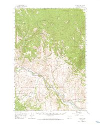
1958 Map of Garrison
USGS Topo · Published 1966About this map
The confluence of the Clark Fork and the Little Blackfoot River anchors this mid-century topographic record of Powell County. The landscape is defined by the heavy infrastructure of the Northern Pacific and the Chicago Milwaukee St Paul and Pacific railroads, which parallel the river valley. The industrial character of the era is evident in the numerous Placer Mines found along the southern gulches and the Strip Mine located near Garrison. Settlement is concentrated at Garrison, Goldcreek, and the small community of Wall City. Beyond the rail corridors, the terrain rises into the Garnet Range to the north and the Deerlodge National Forest to the south. Distinctive landmarks such as Old Baldy Mtn and White Rocks Mountain tower over a network of canyons and gulches, including Limestone Canyon and Tewtel Gulch.
Find a feature on this map
54 named features on this map. Tap any name to fly to it.
Don’t see what you’re looking for? This feature index may not catch every label — zoom into the map to look around manually.
Map Details
Editions of this 1958 Garrison Map
3 editions found

Other maps of this area

1889 · Helena
USGS Topo · 1:250,000

1893 · Helena
USGS Topo · 1:250,000

1899 · Helena
USGS Topo · 1:250,000

1903 · Helena
USGS Topo · 1:250,000

1908 · Philipsburg
USGS Topo · 1:125,000

1919 · Drummond
USGS Topo · 1:125,000

1921 · Drummond
USGS Topo · 1:125,000

1947 · Butte
USGS Topo · 1:250,000

1958 · Butte
USGS Topo · 1:250,000

1958 · Avon
USGS Topo · 1:62,500