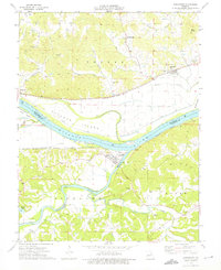
1974 Map of Gasconade
USGS Topo · Published 1975About this map
The confluence of the Missouri River and the Gasconade River shapes this river-bottom landscape in the mid-1970s. Large alluvial landforms like Heckman Island and Miller Island dominate the waterway, while the town of Gasconade sits at the junction of these two major arteries. Transportation and industrial activity are centered along the riverbanks, where the Missouri Pacific and Missouri - Kansas - Texas railroads follow the level terrain.
Find a feature on this map
44 named features on this map. Tap any name to fly to it.
Don’t see what you’re looking for? This feature index may not catch every label — zoom into the map to look around manually.
Map Details
Editions of this 1974 Gasconade Map
This is the sole edition of this map. No revisions or reprints were ever made.
Other maps of this area

1890 · Hermann
USGS Topo · 1:125,000

1890 · Fulton
USGS Topo · 1:125,000

1935 · Morrison
USGS Topo · 1:48,000

1936 · Hermann
USGS Topo · 1:48,000

1940 · Montgomery City
USGS Topo · 1:62,500

1942 · Montgomery City
USGS Topo · 1:62,500

1942 · Morrison
USGS Topo · 1:62,500

1942 · Hermann
USGS Topo · 1:62,500

1942 · New Florence
USGS Topo · 1:62,500

1945 · Hermann
USGS Topo · 1:62,500