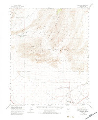
1952 Map of Gass Peak
USGS Topo · Published 1983About this map
Gass Peak dominates the center of this high-desert landscape, serving as a prominent landmark between the Las Vegas Range and the Sheep Range. The 1952 field check captures a critical period of military expansion in Clark County, showing the extensive Nellis Air Force Base Range and its boundary bordering the Desert Game Range Boundary.
Find a feature on this map
21 named features on this map. Tap any name to fly to it.
Don’t see what you’re looking for? This feature index may not catch every label — zoom into the map to look around manually.
Map Details
Editions of this 1952 Gass Peak Map
4 editions found
Other maps of this area

1886 · Saint Thomas
USGS Topo · 1:250,000

1893 · Saint Thomas
USGS Topo · 1:250,000

1907 · Las Vegas
USGS Topo · 1:250,000

1908 · Las Vegas
USGS Topo · 1:250,000

1926 · Boulder Canyon
USGS Topo · 1:96,000

1945 · Sheep Range
USGS Topo · 1:125,000

1952 · Corn Creek Springs
USGS Topo · 1:62,500

1952 · Gass Peak
USGS Topo · 1:62,500

1952 · Blue Diamond
USGS Topo · 1:62,500

1952 · Dry Lake
USGS Topo · 1:62,500