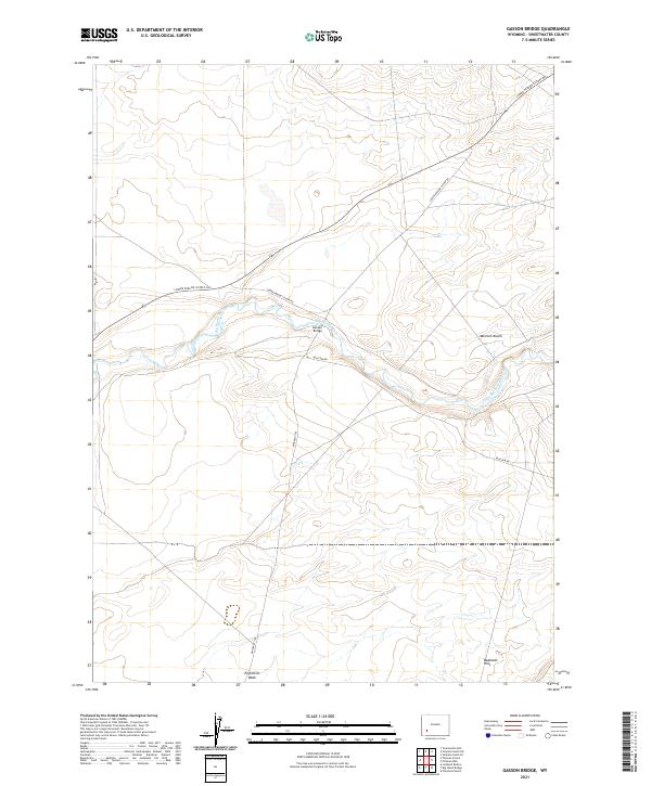
2021 Map of Gasson Bridge
USGS Topo · Published 2021About this map
Emigrant Trl cuts across this high desert landscape, tracing a historical path through the arid terrain of Sweetwater County. The Big Sandy River serves as the primary hydrological artery, winding through a network of dry coulees and plateaus, eventually crossing under the Gasson Bridge. This region is defined by its stark geological formations, most notably the Mormon Knolls and the eroded slopes of the Badlands Hills to the south. The sparse road network, including the Lower Farson Cutoff Rd and Blue Rim Rd, highlights the remote nature of these ranching and rangeland tracts. For those tracing the legacy of Western migration or geological surveys, the map provides a clear look at how historical trails like Emigrant Trl navigate the complex drainage systems of Eightmile Wash.
Find a feature on this map
12 named features on this map. Tap any name to fly to it.
Don’t see what you’re looking for? This feature index may not catch every label — zoom into the map to look around manually.
Map Details
Editions of this 2021 Gasson Bridge Map
This is the sole edition of this map. No revisions or reprints were ever made.
Other maps of this area

1954 · Rock Springs
USGS Topo · 1:250,000

1955 · Lander
USGS Topo · 1:250,000

1958 · Lander
USGS Topo · 1:250,000

1958 · Rock Springs
USGS Topo · 1:250,000

1961 · Lander
USGS Topo · 1:250,000

1962 · Rock Springs
USGS Topo · 1:250,000

1963 · Gasson Bridge
USGS Topo · 1:24,000

1963 · Pittman Well
USGS Topo · 1:24,000

1963 · Big Island Bridge
USGS Topo · 1:24,000
1963 · Thoman School
USGS Topo · 1:24,000