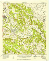
1950 Map of Gatesville
USGS Topo · Published 1953About this map
The Leon River winds through this mid-century landscape, anchoring the regional hub of Gatesville and defining the corridor for the St Louis Southwestern railroad. The map reveals a transition from the civic and educational infrastructure of the town, including the State Reform School and Scott Airfield, to the expanding military footprint of the Fort Hood Military Reservation. This southern sector is dominated by a complex network of training grounds such as the Gatesville Ranges, Owl Creek Ranges, and an expansive Impact Area.
Find a feature on this map
71 named features on this map. Tap any name to fly to it.
Don’t see what you’re looking for? This feature index may not catch every label — zoom into the map to look around manually.
Map Details
Editions of this 1950 Gatesville Map
This is the sole edition of this map. No revisions or reprints were ever made.
Other maps of this area

1888 · Meridian
USGS Topo · 1:125,000

1892 · Temple
USGS Topo · 1:125,000

1892 · Waco
USGS Topo · 1:125,000

1894 · Meridian
USGS Topo · 1:125,000

1894 · Gatesville
USGS Topo · 1:125,000

1920 · Waco
USGS Topo · 1:125,000

1924 · Gatesville 4-a
USGS Topo · 1:48,000

1924 · Temple 2-C
USGS Topo · 1:48,000

1924 · Temple 3-B
USGS Topo · 1:48,000

1930 · Killeen
USGS Topo · 1:62,500