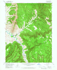
1960 Map of Gateway
USGS Topo · Published 1966About this map
The Dolores River carves a deep path through this 1960 landscape, serving as the primary corridor for movement near the settlement of Gateway. This map captures a significant period of resource extraction in the region, evidenced by numerous named mining operations scattered across the high mesas and canyon walls. Industrial sites like the Mammoth Mine, Liberty Bell No 2 Mine, and Protector Mine indicate a landscape defined by 20th-century mineral exploration and labor.
Find a feature on this map
34 named features on this map. Tap any name to fly to it.
Don’t see what you’re looking for? This feature index may not catch every label — zoom into the map to look around manually.
Map Details
Editions of this 1960 Gateway Map
4 editions found
Other maps of this area

1885 · La Sal
USGS Topo · 1:250,000

1949 · Juanita Arch
USGS Topo · 1:24,000

1949 · Calamity Mesa
USGS Topo · 1:24,000

1949 · Gateway
USGS Topo · 1:24,000

1950 · Juanita Arch
USGS Topo · 1:24,000

1950 · Calamity Mesa
USGS Topo · 1:24,000

1950 · Pine Mountain
USGS Topo · 1:24,000

1952 · Gateway
USGS Topo · 1:24,000

1954 · Mt. Waas 4 SE
USGS Topo · 1:24,000

1954 · Mt. Waas 4 NE
USGS Topo · 1:24,000