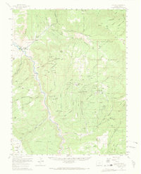
1960 Map of Gateway
USGS Topo · Published 1968About this map
Gateway serves as the primary gateway to the high plateau country of western Colorado, situated at the confluence of the Dolores River and Unaweep Canyon. The 1960 landscape is defined by its deep uranium and vanadium mining history, with numerous operations such as the Vanakin No 1 Mine, Liberty Bell No 2 Mine, and Stormy Treasure Mine scattered across the surrounding mesas. The sheer cliffs of The Palisade tower over the valley, while the rugged interior is marked by specialized outposts like Calamity Camp and Arrowhead Camp.
Find a feature on this map
65 named features on this map. Tap any name to fly to it.
Don’t see what you’re looking for? This feature index may not catch every label — zoom into the map to look around manually.
Map Details
Editions of this 1960 Gateway Map
4 editions found
Other maps of this area

1885 · La Sal
USGS Topo · 1:250,000

1916 · Paradox Valley
USGS Topo · 1:125,000

1922 · Paradox Valley
USGS Topo · 1:125,000

1948 · Roc Creek
USGS Topo · 1:24,000

1949 · Roc Creek
USGS Topo · 1:24,000

1949 · Juanita Arch
USGS Topo · 1:24,000

1949 · Atkinson Creek
USGS Topo · 1:24,000

1949 · Red Canyon
USGS Topo · 1:24,000

1949 · Calamity Mesa
USGS Topo · 1:24,000

1949 · Gateway
USGS Topo · 1:24,000